When is sargassum season in the Riviera Maya?
The pattern is real and the calendar is only half the answer. Every dated figure below comes from the state's own reports, the Navy's bulletins and the satellite lab that tracks the belt, read on 25 September 2026.
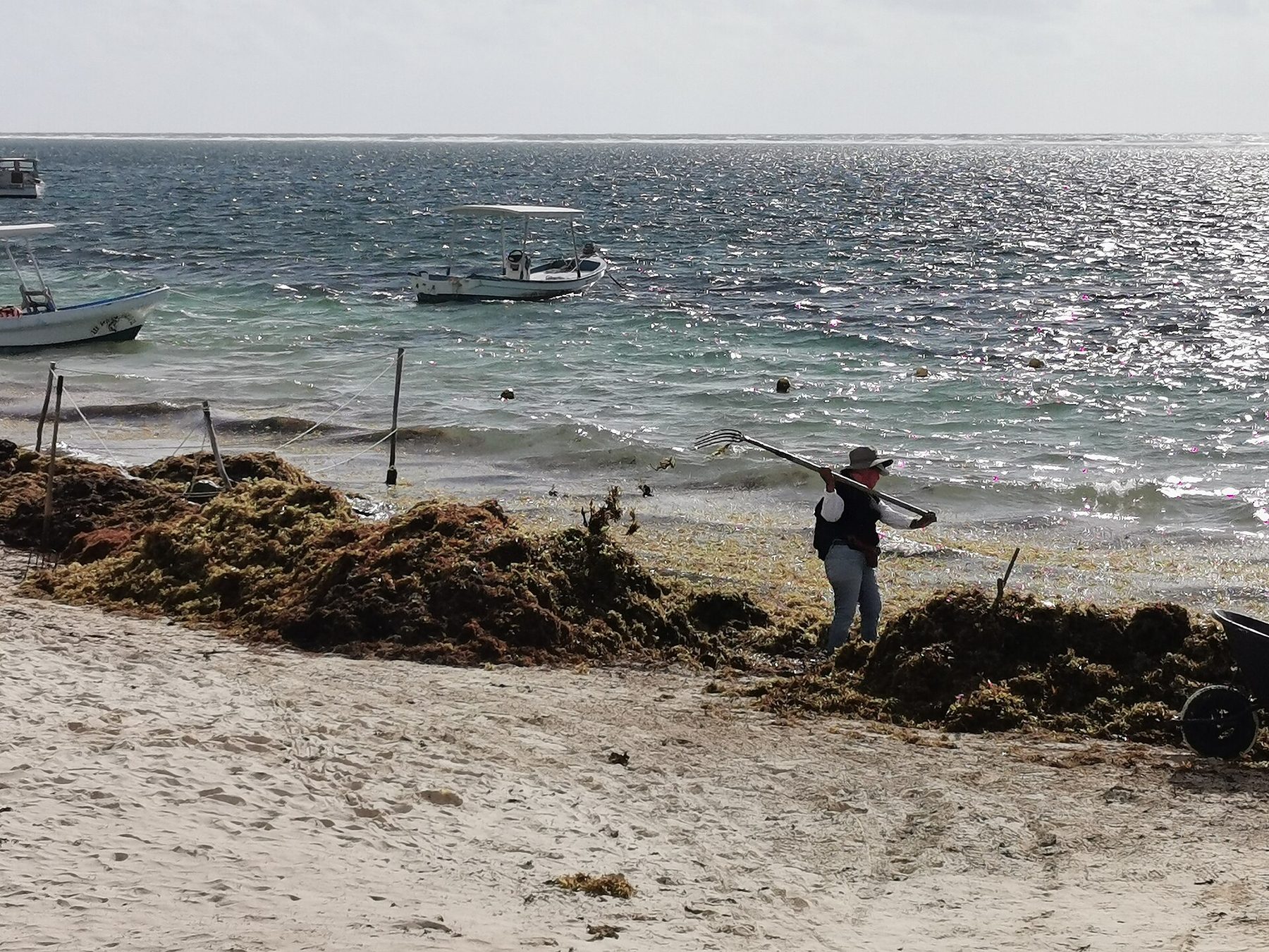
On a bad morning the brown band sits where the turquoise should be. A crew works the waterline with hand tools, and the sea past the barrier looks perfect. That week lands somewhere on this coast most years now, and it has a shape: inside the Atlantic belt that formed in 2011, sargassum peaks in June or July. 1
Before 2011 the seaweed mostly stayed out at sea. It lived in the Sargasso Sea and the Gulf of Mexico. Then its range widened into one continuous belt from West Africa to the Gulf, and Caribbean beaches began receiving it in quantity. NOAA now runs a satellite Sargassum Inundation Report that scores the chance of landfall within 50 km of a coast on three levels. 1, 10
The month sets the odds and the wind picks the week. USF, the lab behind the satellite tracking, measures how much floats offshore and says beach-level landfall stays hard to forecast. Wind, swell and currents put the mats on one coast and spare the other. That is how two beaches in the same state read green and red on the same morning. 1, 3
| Date | Worst that day | Reported clear or light |
|---|---|---|
| 15 March 2026 | El Naranjal and Xcalak on the far south coast, red | Cancún and Puerto Morelos green; Tulum, Akumal, Playa del Carmen and Mahahual yellow |
| 18 June 2026 | 37 of 40 southern-zone beaches red | Isla Mujeres (Playa Norte, Playa Centro, Punta Sur) and Holbox green or blue |
| 18 August 2026 | Cozumel's east coast, 6 to 10 tons lifted a day | Island-wide alert yellow |
| 27 August 2026 | 17 tons forecast for Puerto Morelos and 16 for Xcacel within 24 hours | Navy alert cut from red to yellow statewide |
| 4 September 2026 | 123,000 tons collected since January | Playa del Carmen's barrier line now 5 km |
| 22 September 2026 | 135 of 140 monitored beaches carried sargassum | 3 rated clear, all of them restricted |
Each row describes the day named. The color ratings belong to Quintana Roo's environment secretariat and the Navy's bulletins, as reported by the outlets cited; the March figures were published citing two citizen trackers. 11, 7
How much seaweed did 2026 actually bring?
2026 is the heaviest year Quintana Roo has counted. Federal authorities put the January to 27 August total at 90,548 tons, the highest year-to-date figure in about six years of monitoring. Eight days later the count passed 123,000 tons. Work out the gap and it comes to 32,452 tons in eight days, about 4,056 tons a day, along the beaches of one state. 12, 2
| Count date | Tons since January | Days since last count | Tons a day in between |
|---|---|---|---|
| 27 August 2026 | 90,548 | - | - |
| 4 September 2026 | 123,000 or more | 8 | about 4,056 |
Both totals are government counts presented at Navy supervision events and reported by Heraldo de México Quintana Roo. Of the September figure, more than 50,000 tons came from Navy work, about 41 percent, and around 20,000 tons were lifted out of the water before reaching sand, about 16 percent. 2
The beach-level version of that tonnage is older and starker. USF recorded hotels along this coast removing 1,000 to 10,000 tons per kilometre of beach during the peak months of 2018 and 2019, across seven beaches. That is the scale a peak reaches when the mats arrive faster than anyone can catch them offshore. 1
Then it eased. On 27 August 2026 the Navy cut its Quintana Roo alert from red to yellow, with arrivals well below the May and June peak, while still forecasting 17 tons for Puerto Morelos and 16 tons for Xcacel, a state-protected turtle sanctuary, within 24 hours. Industry voices in the same report expected roughly two more months before Playa del Carmen's water fully cleared. 12
USF's own August outlook agreed, with one caution. Volume fell in every region that month and still sat above the 75th percentile of historical levels everywhere except the east Atlantic. The lab expected the decline to carry on through the following months, possibly until November. 1
Where the water stays clear: the north and the islands
This coast splits north and south, and the split is wide. On 22 September 2026 the state's monitoring covered 140 beaches. In the 100-beach northern zone, 62 were clear or lightly touched and 16 were abundant or excessive. In the 40-beach southern zone, 6 were clear or light and 29 were abundant or excessive. Same state, same morning. 9
Table view: North against south on one September morning
| Item | North (100 beaches) (%) | South (40 beaches) (%) |
|---|---|---|
| Clear or low | 62% | 15% |
| Moderate | 22% | 12.50% |
| Abundant or excessive | 16% | 72.50% |
Read the gap, not the average. The northern zone runs from the islands and Cancún down the coast; the southern zone covers Mahahual, Xcalak and the far south. Percentages are worked from the beach counts in the state's report for that day. Source: 9
Isla Mujeres and Holbox are the north's strongest card. On 18 June 2026, deep in the peak, Playa Norte, Playa Centro and Punta Sur on Isla Mujeres read green or blue, and Holbox held nil to very low levels. The same report put southeast winds of 30 to 40 km/h and a 1.9 m swell behind the seaweed piling onto the southern coast. 3
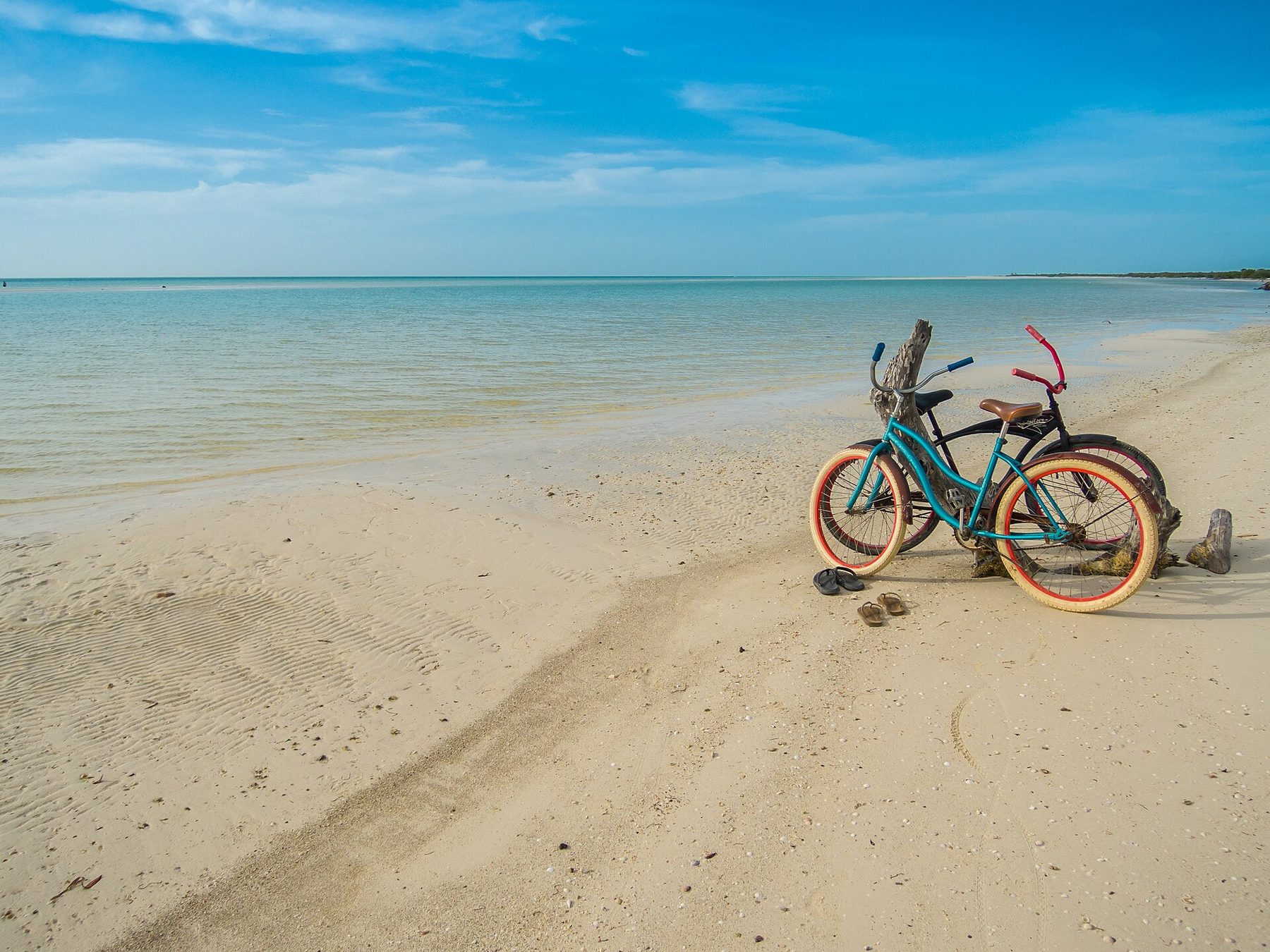
Tulum and Akumal face the belt directly, with no island to break it. This stretch reads yellow more often than green: on 15 March 2026, Cancún and Puerto Morelos held green while Tulum, Akumal, Playa del Carmen and Mahahual all read yellow. 11 Xcacel, the turtle sanctuary between Akumal and Tulum, was one of two beaches the Navy named on 27 August 2026, with 16 tons forecast within 24 hours. 12
Is Cozumel clear of sargassum?
Cozumel's problem sits on the east coast, the side almost nobody sleeps on. Zofemat, the municipal authority for the federal shoreline, works the eastern beaches every day: the Chumul lookouts and Chen Río, 6 to 10 tons lifted daily across as much as 700 linear metres, by 54 people with hand tools. Turtle nests and environmental rules keep the machines away. 4
Which leaves the west side, where the town, the ferry and the dive boats are, usually clear. Usually carries weight here. Arturo Can Novelo, Zofemat's director in Cozumel, set out the east-coast work to Heraldo de México on 18 August 2026, the day the island held a yellow alert. The same report describes an irregular storm dumping 15 tons on the west-facing malecón the week before. 4
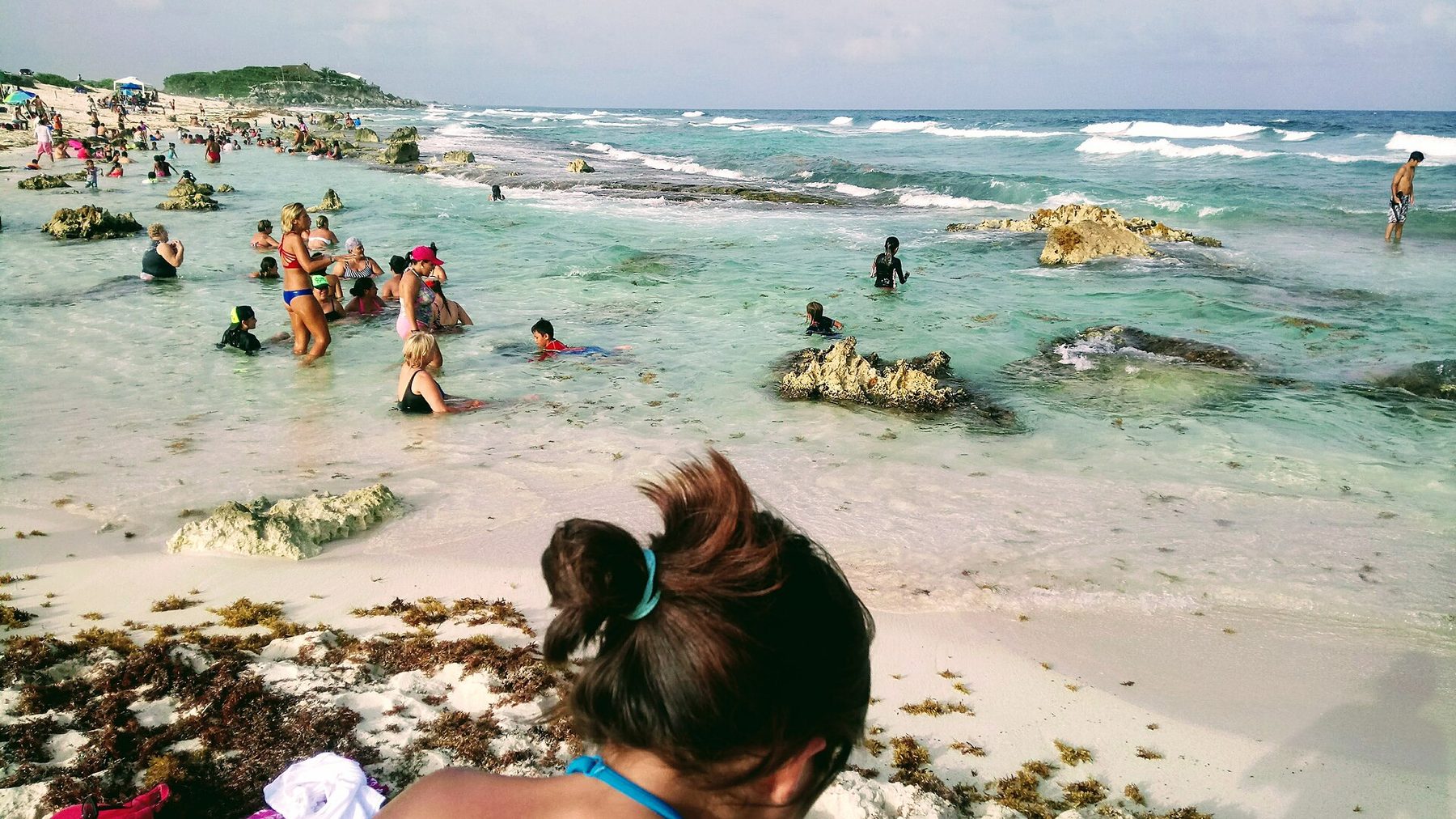
March 2026 is the reminder. Over the weekend of 15 March, monitoring portals put El Naranjal, Xcalak and Isla de las Golondrinas on red. Among eight beaches rated moderate between Tulum and Cancún that weekend was El Cielo, Cozumel's shallow snorkelling spot. Seaweed in a quiet month, on the island's calm side. 11
Sargassum is a surface problem, and that shapes the plan. It floats, and it piles where water meets sand. 1, 10 A shore snorkel is the morning a red flag spoils; a boat day offshore is the one that usually survives. Price both before you book: MMT's Cozumel diving budget covers the boats and the beds, and the marine park fees are a separate line.
When is the best time to visit Cancún?
Book outside June and July and you cut the odds. That is the whole of the seasonal advice the evidence carries. The Atlantic belt peaks in those two months, and USF expected 2026 volumes to keep falling into the autumn, possibly until November. Winter and early spring brought the lighter reports this year: on 15 March, Cancún and Puerto Morelos both read green. 1, 11
- December to April looks like the lower-risk window on 2026's reports, with Cancún and Puerto Morelos green in mid-March while the far south ran red. 11
- May to August is when the belt arrives. The Navy's alert stood at red through the May and June peak and came down to yellow on 27 August. 12
- September and October are recovery, not clarity. On 22 September 2026, 135 of 140 monitored beaches still carried sargassum, and the Navy planned to take vessel operations down to 70 percent of capacity between late September and early October. 9, 2
- November closes the cycle in a declining year. USF's August outlook expected volume to keep dropping in every region, possibly until that month. 1
One caveat sits under the calendar. These windows are odds drawn from one heavy year's reports, and the wind still picks the week. Anyone booking a beach-first trip in June should treat the daily bulletin as part of packing and hold a plan for a red morning. 5
How do you check today's beach report?
Two official sources, both free. Mexico's Navy, through its Instituto Oceanográfico del Golfo y Mar Caribe, has published a daily sargassum bulletin for the Mexican Caribbean since 2019, with today's edition and an archive behind it: Semar's bulletin page. USF's lab issues a regional outlook by the last day of each month on its Sargassum Watch System page. 5, 1
The beach-by-beach layer belongs to the state. Quintana Roo's environment secretariat runs a monitoring centre inside the state's C5 command hub, reading imagery from European Space Agency satellites to rate more than 140 beaches and publish daily forecasts. Those ratings are the colors behind every snapshot on this page. 6, 9
| Color | What the beach looks like | What it means for the morning |
|---|---|---|
| Green | No sargassum, or minimal amounts | Swim |
| Yellow | Moderate arrival; algae possible along the waterline | Swim, and expect some weed on the sand |
| Orange | Abundant arrival, with visible strips on the beach and in the water | Move along the coast, or take the boat day |
| Red | Excessive arrival covering the shore and the water beside it | Choose another beach |
Categories as the state's environment secretariat defines them, summarized by a Quintana Roo outlet. Blue sits alongside green on some daily maps for beaches reading nil. 7, 3
The maps travellers actually open are citizen projects. On 25 September 2026, sargazo.info listed 74 monitored beaches across 10 Quintana Roo towns and called 42 of them clean that day: sargazo.info. Sargassum Monitoring, a Texas-registered nonprofit, has gathered crowdsourced photos and reports in more than 43 countries since 2018. Both mix community reports with official data, and say so. 13, 14
Two days out, read the Navy
Semar's bulletin page carries today's edition and the archive back to 2019. This is the official Mexican answer for the Caribbean coast. 5
770 million spent, 2,000 million promised
Two governments are spending here at once. On 30 July 2026, Quintana Roo's governor said her administration had invested more than 770 million pesos in an integrated sargassum response. The same day, Mexico's Navy secretary set out a reinforcement worth more than 2,000 million pesos in two stages: more collection vessels, more containment barriers, more equipment for the beaches. 15
Table view: Announced sargassum spending, as stated on 30 July 2026
| Item | Value (MXN million) |
|---|---|
| Quintana Roo state, invested to date | 770 MXN million |
| Navy reinforcement, two stages | 2,000 MXN million |
Two different kinds of figure: one is money the state says it has already spent, the other a federal commitment announced in two stages. Together they are the scale of the response a visitor sees as boats, barriers and crews. Source: 15
On the sand, that money reads as barrier metres. Playa del Carmen opened 2026 with 2,600 metres of marine barrier, reached 5 kilometres by February, an extra 2,400 metres, and by September the Navy was studying up to 10,000 metres more, pending work on currents, winds and tides. The national strategy runs in five stages: monitoring, collection in open water, coastal collection, containment by barrier, and beach cleaning. 2
Catching it at sea is the part that shows. Of the 123,000-plus tons collected by 4 September 2026, more than 50,000 came from Navy work, about 41 percent, and roughly 20,000 tons were lifted out of the water before reaching a beach, about 16 percent. Every ton stopped offshore is a ton that stays off the sand. 2
Build the week so one red beach costs you nothing
The money question under all of this is refundability. A beach that turns red for three days changes a snorkel plan, a boat day, sometimes a hotel. What it costs you depends on the terms you agreed to. Book the flexible version of anything that depends on the sand, and read the cancellation wording before you pay: MMT's guide to what is actually refundable sets out the questions to ask.
- Sleep north, travel south for the day. Isla Mujeres and Holbox held green and blue through the June 2026 peak while the southern zone ran red on 37 of its 40 monitored beaches. 3
- In Cozumel, stay west. The crews, the tonnage and the hand tools are all on the east coast. 4
- Put the boat morning in the heavy week. Offshore water is the part sargassum leaves alone; the shoreline is the part it takes. 1
- Keep one day loose, away from the sand. A red morning is easier to absorb when something inland is already on the list.
- Ask the hotel what it does on a red day. Hotels along this coast were removing 1,000 to 10,000 tons per kilometre at the 2018 and 2019 peaks, so the answer exists somewhere in the building. 1
- Set the wider budget first. MMT's Mexico travel guide covers the regional routes and the arrival day this decision sits inside.
Frequently asked questions
Is there a sargassum-free month in the Riviera Maya?
The evidence supports lower odds, not a clear month. The Atlantic belt peaks in June or July, and USF expected 2026 volumes to keep falling into the autumn, possibly until November. Even on a good day in a heavy year the clear list runs short: on 22 September 2026, three beaches statewide were rated completely free of it. 1, 8
Does sargassum reach Isla Mujeres and Holbox?
Less than the mainland, and wind decides which week. Southeast winds of 30 to 40 km/h and a 1.9 metre swell push sargassum onto the southern coast while the islands stay sheltered, which is why Isla Mujeres and Holbox read green or blue on 18 June 2026 even as the southern zone's beaches ran red. 3
Was 2026 a heavier sargassum year than usual?
Yes. Federal authorities recorded 90,548 tons collected in Quintana Roo by 27 August 2026, the highest year-to-date figure in about six years of monitoring, and the count passed 123,000 tons by 4 September. USF's August update still put volumes above the 75th percentile of historical levels in every region except the east Atlantic. 12, 2, 1
How far ahead can I trust a sargassum forecast?
A month for the region, a day for the beach. USF's outlook covers regions and its own page asks readers to avoid using it to predict conditions at a specific beach. Landfall depends on local wind, tides and currents, which is why the state re-rates more than 140 beaches every day. 1, 6
Who clears the beach in front of my hotel?
It depends who holds the shoreline. In Cozumel the municipal Zofemat crews work the eastern beaches by hand, and much of the south of the island is under concession to private clubs, where cleaning falls to the concession holder. On the mainland, hotels were removing 1,000 to 10,000 tons per kilometre at the 2018 and 2019 peaks. 4, 1
What does blue mean on the sargassum map?
Blue sits with green at the clear end of the scale. Some daily maps show blue for beaches reading nil, where green covers nil or minimal amounts. 7, 3
Can a storm clear the seaweed away?
Weather moves it, in both directions. An irregular storm put 15 tons onto Cozumel's west-facing malecón in the week before 18 August 2026, a stretch that usually stays clear, while an autumn shift in the wind was expected to help close out the 2026 season. Treat any single forecast as one input. 4, 12
Sources & review date
Researched 2026-09-25. Prepared from primary sources, with a separate independent source review. Numbered notes in the text point to the sources below. Prices, entry rules and schedules change; use the linked authority for your dates.
- 1Sargassum Watch System (SaWS): outlook bulletins, FAQ and August 2026 update University of South Florida, Optical Oceanography Laboratory · Accessed 2026-09-25 · Primary source
- 2Analizan ampliar hasta 10 kilómetros las barreras contra el sargazo en Playa del Carmen Heraldo de México Quintana Roo · Accessed 2026-09-25
- 3Semáforo de sargazo en Quintana Roo: Holbox e Isla Mujeres limpias Heraldo de México Quintana Roo · Accessed 2026-09-25
- 4Cozumel mantiene semáforo amarillo por sargazo, con hasta 10 toneladas diarias retiradas Heraldo de México Quintana Roo · Accessed 2026-09-25
- 5Boletines de sargazo, Instituto Oceanográfico del Golfo y Mar Caribe Secretaría de Marina, Armada de México · Accessed 2026-09-25 · Primary source
- 6Quintana Roo ha invertido 770 millones de pesos para monitorear la llegada de sargazo a sus costas Notisistema · Accessed 2026-09-25
- 7Semáforo de sargazo: cómo leerlo y saber qué playas están limpias Quinta Fuerza · Accessed 2026-09-25
- 8Sin sargazo: esta es la lista de playas limpias de este 22 de septiembre en Quintana Roo Heraldo de México Quintana Roo · Accessed 2026-09-25
- 9QRoo: sargazo aún presente en 135 playas de las 140 monitoreadas REPORTUR.mx · Accessed 2026-09-25
- 10Tracking Sargassum: the Sargassum Inundation Report NOAA Atlantic Oceanographic and Meteorological Laboratory · Accessed 2026-09-25 · Primary source
- 11Activan semáforo rojo por sargazo en costas de Xcalak y Cozumel PorEsto! · Accessed 2026-09-25
- 12Semar baja a amarillo la alerta por sargazo en Quintana Roo Heraldo de México Quintana Roo · Accessed 2026-09-25
- 13Sargazo en Quintana Roo: mapa y reportes por playa sargazo.info (citizen reporting) · Accessed 2026-09-25
- 14Sargassum Monitoring: citizen science network and official map Sargassum Monitoring Inc. (nonprofit) · Accessed 2026-09-25
- 15Gobierno federal y Quintana Roo refuerzan estrategia para atender el sargazo: se han invertido 770 mdp El Universal · Accessed 2026-09-25